Tyne and Wear Metro: Difference between revisions
m Added info about the red and blue lines |
Hopperelec (talk | contribs) Added photos for rolling stock (metrocar, 555 and BL), and a network diagram for Tyneside Electrics |
||
| (15 intermediate revisions by 2 users not shown) | |||
| Line 1: | Line 1: | ||
{{Wikipedia equivalent|Tyne and Wear Metro}}[[File:Metro logo (Oct 2019).svg|alt=Tyne and Wear Metro logo. On top: yellow square containing black M. On bottom: black strip containing white txt "METRO"|thumb|Tyne and Wear Metro logo as of October 2019|295x295px]] | |||
The '''Tyne and Wear Metro''' is an overground and underground light rail rapid transit system serving many areas of Tyne and Wear in the North East of England. It is owned and operated by [[Tyne and Wear Passenger Transport Executive|Tyne and Wear Passenger Transport Executive (Nexus)]]. | The '''Tyne and Wear Metro''' is an overground and underground light rail rapid transit system serving many areas of Tyne and Wear in the North East of England. It is owned and operated by [[Tyne and Wear Passenger Transport Executive|Tyne and Wear Passenger Transport Executive (Nexus)]]. | ||
=== Rolling stock === | === Rolling stock === | ||
The Tyne and Wear Metro currently uses two classes of rolling stock for passenger service. The system started with 90 [[Metrocar|metrocars]], manufactured by Metro-Cammell. However, many of these have now been scrapped while the fleet is replaced by 46 of the new [[Class 555|Class 555s]], manufactured by [[Stadler]]. The new trains first entered passenger service in December 2024<ref>Nexus (18 | The Tyne and Wear Metro currently uses two classes of rolling stock for passenger service. The system started with 90 [[Metrocar|metrocars]], manufactured by [[Metro-Cammell]]. However, many of these have now been scrapped while the fleet is replaced by 46 of the new [[Class 555|Class 555s]], manufactured by [[Stadler]]. The new trains first entered passenger service in December 2024<ref>Nexus ({{#dateformat:18 december 2025}}). [https://www.nexus.org.uk/news/item/metros-first-new-train-enters-customer-service "Metro’s first new train enters customer service"] ([https://web.archive.org/web/20241219144259/https://www.nexus.org.uk/news/item/metros-first-new-train-enters-customer-service archived])</ref> and are expected to all be in service by the end of 2026<ref>Nexus ({{#dateformat:14 august 2025}}). [https://www.nexus.org.uk/news/item/metros-old-trains-deliver-recycling-boost-their-final-journeys "Metro’s old trains deliver recycling boost on their final journeys"]</ref><ref>Nexus ({{#dateformat:18 february 2025}}). [https://www.nexus.org.uk/news/item/new-metro-fleet-enters-customer-service-sunderland-line "New Metro fleet enters customer service on the Sunderland line"] ([https://web.archive.org/web/20250308003424/https://www.nexus.org.uk/news/item/new-metro-fleet-enters-customer-service-sunderland-line archived])</ref>. | ||
Alongside the passenger stock, Metro also owns and operates three [[Metro's battery locomotives|battery locomotives]] (BL1, BL2 and BL3), a ballast tamper ([[MA‑60]]), five hopper wagons, eight bogie flat wagons, and two low height spoil wagons.<ref>Nexus | Alongside the passenger stock, Metro also owns and operates three [[Metro's battery locomotives|battery locomotives]] (BL1, BL2 and BL3), a ballast tamper ([[MA‑60]]), five hopper wagons, eight bogie flat wagons, and two low height spoil wagons.<ref>Nexus ({{#dateformat:4 July 2016}}). [https://www.whatdotheyknow.com/request/metro_train_specifications#incoming-833680 "Metro Train Specifications - a Freedom of Information request to Tyne and Wear Passenger Transport Executive"] ([https://web.archive.org/web/20211108134005/https://www.whatdotheyknow.com/request/metro_train_specifications#incoming-833680 archived]), ''WhatDoTheyKnow''</ref><gallery widths="200" heights="150"> | ||
File:Metrocar 4087.JPEG|Metrocar 4087 | |||
File:555004.JPEG|Unit 555004 | |||
File:Tyne-and-wear-metro-depot-shunter.jpg|Battery loco BL1 dragging a metrocar | |||
</gallery> | |||
=== Network === | === Network === | ||
The Metro network is made up of roughly 172km of rail<ref>Produced based on data from OpenStreetMap; [https://overpass-api.de/api/interpreter?data=%5Bout%3Ajson%5D%3B%0Arel%5B%22operator%22%3D%22Nexus%22%5D%3B%0A%28%0A%20%20%3E%3E%3B%0A%20%20way%5B%22operator%22%3D%22Nexus%22%5D%3B%0A%29-%3E.w%3B%0A%28%0A%20%20way.w%5B%22railway%22%3D%22rail%22%5D%3B%0A%20%20way.w%5B%22railway%22%3D%22light_rail%22%5D%3B%0A%20%20way%28132716726%29%3B%20%2F%2F%20FGT-BYW%20crossover%0A%20%20way%28132716718%29%3B%20%2F%2F%20BYW-EBO%20crossover%0A%20%20way%28248095218%29%3B%20%2F%2F%20BYW-EBO%20crossover%0A%20%20way%28248095206%29%3B%20%2F%2F%20SUN-MSP%20crossover%0A%20%20way%28248095216%29%3B%20%2F%2F%20SUN-PLI%20crossover%0A%29%3B%0A%28._%3B%3E%3B%29%3B%0Aout%20skel%3B Overpass query].</ref>, 2 lines (yellow line and green line), 60 stations, 9 sets of sidings, 42 crossovers<ref>OpenStreetMap contributors; [https://overpass-api.de/api/interpreter?data=%5Bout%3Ajson%5D%3B%0Arel%5B%22operator%22%3D%22Nexus%22%5D%3B%0A%28%0A%20%20%3E%3E%3B%0A%20%20way%5B%22operator%22%3D%22Nexus%22%5D%3B%0A%20%20way%28132716726%29%3B%20%2F%2F%20FGT-BYW%20crossover%0A%20%20way%28132716718%29%3B%20%2F%2F%20BYW-EBO%20crossover%0A%20%20way%28248095218%29%3B%20%2F%2F%20BYW-EBO%20crossover%0A%20%20way%28248095206%29%3B%20%2F%2F%20SUN-MSP%20crossover%0A%20%20way%28248095216%29%3B%20%2F%2F%20SUN-PLI%20crossover%0A%29-%3E.w%3B%0Away.w%5B%22service%22%3D%22crossover%22%5D%3B%0Aout%20body%20geom%3B Overpass query]</ref>, [[Gosforth Depot]], [[Howdon Satellite Depot]], [[Hylton Street Permanent Way Depot]], [[Nexus Learning Centre]], [[Gosforth Depot avoiding line|the avoid line]], and [[the Manors curve]]. | The Metro network is made up of roughly 172km of rail<ref>Produced based on data from OpenStreetMap; [https://overpass-api.de/api/interpreter?data=%5Bout%3Ajson%5D%3B%0Arel%5B%22operator%22%3D%22Nexus%22%5D%3B%0A%28%0A%20%20%3E%3E%3B%0A%20%20way%5B%22operator%22%3D%22Nexus%22%5D%3B%0A%29-%3E.w%3B%0A%28%0A%20%20way.w%5B%22railway%22%3D%22rail%22%5D%3B%0A%20%20way.w%5B%22railway%22%3D%22light_rail%22%5D%3B%0A%20%20way%28132716726%29%3B%20%2F%2F%20FGT-BYW%20crossover%0A%20%20way%28132716718%29%3B%20%2F%2F%20BYW-EBO%20crossover%0A%20%20way%28248095218%29%3B%20%2F%2F%20BYW-EBO%20crossover%0A%20%20way%28248095206%29%3B%20%2F%2F%20SUN-MSP%20crossover%0A%20%20way%28248095216%29%3B%20%2F%2F%20SUN-PLI%20crossover%0A%29%3B%0A%28._%3B%3E%3B%29%3B%0Aout%20skel%3B Overpass query].</ref>, 2 lines ([[yellow line]] and [[green line]]), 60 [[List of Metro stations|stations]], 9 sets of sidings, 42 crossovers<ref>OpenStreetMap contributors; [https://overpass-api.de/api/interpreter?data=%5Bout%3Ajson%5D%3B%0Arel%5B%22operator%22%3D%22Nexus%22%5D%3B%0A%28%0A%20%20%3E%3E%3B%0A%20%20way%5B%22operator%22%3D%22Nexus%22%5D%3B%0A%20%20way%28132716726%29%3B%20%2F%2F%20FGT-BYW%20crossover%0A%20%20way%28132716718%29%3B%20%2F%2F%20BYW-EBO%20crossover%0A%20%20way%28248095218%29%3B%20%2F%2F%20BYW-EBO%20crossover%0A%20%20way%28248095206%29%3B%20%2F%2F%20SUN-MSP%20crossover%0A%20%20way%28248095216%29%3B%20%2F%2F%20SUN-PLI%20crossover%0A%29-%3E.w%3B%0Away.w%5B%22service%22%3D%22crossover%22%5D%3B%0Aout%20body%20geom%3B Overpass query]</ref>, [[Gosforth Depot]], [[Howdon Satellite Depot]], [[Hylton Street Permanent Way Depot]], [[Nexus Learning Centre]], [[Gosforth Depot avoiding line|the avoid line]], and [[Manors ECS Curve|the Manors curve]]. | ||
The green | The [[green Line]] runs between [[Airport]] and [[South Hylton]] and is 37.5 km long<ref>OpenStreetMap contributors and calculations from [https://brouter.de/brouter-web/#map=11/55.0051/-1.6390/standard&lonlats=-1.710901,55.035266;-1.448146,54.904004&profile=rail BRouter]</ref>. The [[yellow Line]] runs between [[St James]] and [[South Shields]] and is 50.5 km long<ref>OpenStreetMap contributors and calculations from [https://brouter.de/brouter-web/#map=12/55.0137/-1.5855/standard&lonlats=-1.620677,54.974433;-1.43657,55.035149;-1.433104,54.997564&profile=rail BRouter]</ref>. The track between and including [[South Gosforth]] and [[Pelaw]] is shared between both lines. The yellow line north of the Tyne is known as the "North Tyneside loop". The yellow line is also one of the few rapid transit systems in the world to use a "pretzel configuration", in which it passes the same station ([[Monument]]) twice for each destination and from different platforms. | ||
Most of the network is owned by Metro. However, the green line between [[Pelaw Junction]] and [[South Hylton]] (inclusive) is owned and operated by Network Rail<ref>Office of Rail and Road (15 | Most of the network is owned by Metro. However, the green line between [[Pelaw Junction]] and [[South Hylton]] (inclusive) is owned and operated by Network Rail<ref>Office of Rail and Road ({{#dateformat:15 march 2022}}). [https://www.orr.gov.uk/sites/default/files/2022-04/nexus-track-access-consolidated-agreement.pdf "Track access agreement between Network Rail and Nexus"] ([https://web.archive.org/web/20230118213424/https://www.orr.gov.uk/sites/default/files/2022-04/nexus-track-access-consolidated-agreement.pdf archived])</ref>, with the line between and including [[Fellgate]] and [[Sunderland]] shared with heavy rail. As a result, all Metro trains in this section of the network, including empty coaching stock that doesn't usually show on the [[Pop app]], can be tracked through services like [https://www.realtimetrains.co.uk/ Realtime Trains] and [https://signalmaps.co.uk/#sunderland:3248 Signal Maps]. Metro owns all of its stations, including those on Network Rail infrastructure<ref>The Tyne and Wear Passenger Transport (Sunderland) Order 1998, SI 1998/3269 ([https://www.legislation.gov.uk/uksi/1998/3269/contents/made/data.pdf legislation.gov.uk])</ref>, except for [[Sunderland]] which is owned by Network Rail and managed by Northern Trains<ref>Office of Rail and Road ({{#dateformat:12 january 2024}}). [https://orrprdpubreg1.blob.core.windows.net/docs/S-22-375-24-02-amendments-to-the-SAC-for-Sunderland-station.pdf "Amendments to the SAC for Sunderland station"]</ref>, and except for Tynemouth which is owned by Station Developments Ltd<ref>Nexus ({{#dateformat:13 april 2011}}). [https://www.nexus.org.uk/news/item/tynemouth-preserved "Tynemouth preserved"] ([https://web.archive.org/web/20151019134020/https://www.nexus.org.uk/news/item/tynemouth-preserved archived])</ref>. | ||
Previously, there was red and blue lines, which ran in peak times only. The red line ran between Benton and Pelaw, while the blue line ran between North Shields and St. James. | Previously, there was red and blue lines, which ran in peak times only. The red line ran between Benton and Pelaw, while the blue line ran between North Shields and St. James. Peak services still run today, except not on their own dedicated line. | ||
{| class="wikitable sortable mw-collapsible mw-collapsed" style="width:100%" | {| class="wikitable sortable mw-collapsible mw-collapsed" style="width:100%" | ||
|+List of current Tyne and Wear Metro stations | |+List of current Tyne and Wear Metro stations | ||
!Station | !Station | ||
!Code<ref group="lower-alpha">Where there are two codes, the first is used by [[Nexus]] and the second is used by National Rail</ref> | !Code<ref group="lower-alpha">Where there are two codes, the first is the one currently used by [[Nexus]] and the second is either an outdated code or the CRS code used by National Rail</ref><ref>[https://metro-rti.nexus.org.uk/api/stations metro-rti.nexus.org.uk/api/stations] ([https://web.archive.org/web/20220209154031/https://metro-rti.nexus.org.uk/api/stations archived])</ref><ref>Railway Codes. [http://www.railwaycodes.org.uk/crs/crs0.shtm "CRS, NLC, TIPLOC and STANOX Codes"] (accessed {{#dateformat:22 August 2025}})</ref> | ||
!Opened (for Metro) | !Opened (for Metro) | ||
!Platforms | !Platforms | ||
| Line 128: | Line 132: | ||
|- | |- | ||
![[Heworth ]] | ![[Heworth ]] | ||
| | |HTH, HEZ | ||
|{{#dateformat:15 Nov 1981}} | |{{#dateformat:15 Nov 1981}} | ||
|1, 2 | |1, 2 | ||
| Line 148: | Line 152: | ||
|- | |- | ||
![[Jesmond ]] | ![[Jesmond ]] | ||
|JES | |JES, JSM | ||
|{{#dateformat:11 Aug 1980}} | |{{#dateformat:11 Aug 1980}} | ||
|1, 2 | |1, 2 | ||
| Line 168: | Line 172: | ||
|- | |- | ||
![[Meadow Well ]] | ![[Meadow Well ]] | ||
|MWL | |MWL, MDW | ||
|{{#dateformat:14 Nov 1982}} | |{{#dateformat:14 Nov 1982}} | ||
|1, 2 | |1, 2 | ||
| Line 178: | Line 182: | ||
|- | |- | ||
![[Monkseaton ]] | ![[Monkseaton ]] | ||
|MSN | |MSN, MSP | ||
|{{#dateformat:11 Aug 1980}} | |{{#dateformat:11 Aug 1980}} | ||
|1, 2 | |1, 2 | ||
|- | |- | ||
![[Monument ]] | ![[Monument ]] | ||
|MMT<ref group="lower-alpha"> | |MMT<ref group="lower-alpha">In timetables and some APIs, Nexus also uses MTS for platforms 1 and 2, MTN for specifically platform 1, MTW for platforms 3 and 4, and MTE for specifically platform 3.</ref> | ||
|{{#dateformat:15 Nov 1981}} | |{{#dateformat:15 Nov 1981}} | ||
|1, 2, 3, 4 | |1, 2, 3, 4 | ||
| Line 233: | Line 237: | ||
|- | |- | ||
![[Shiremoor ]] | ![[Shiremoor ]] | ||
|SMR | |SMR, SHM | ||
|{{#dateformat:11 Aug 1980}} | |{{#dateformat:11 Aug 1980}} | ||
|1, 2 | |1, 2 | ||
|- | |- | ||
![[Simonside ]] | ![[Simonside ]] | ||
|SMD | |SMD, SMN | ||
|{{#dateformat:17 Mar 2008}} | |{{#dateformat:17 Mar 2008}} | ||
|1, 2 | |1, 2 | ||
| Line 325: | Line 329: | ||
|+List of non-passenger stops on the Metro network | |+List of non-passenger stops on the Metro network | ||
!Name | !Name | ||
!Code | !Code<ref>Used in various Nexus timetables and in 'Metro Rule Book's</ref> | ||
!Adjacent stops | !Adjacent stops | ||
!Number of storage spaces<ref group="lower-alpha">One [[Class 555|555]], two [[Metrocar|metrocars]]</ref> | !Number of storage spaces<ref group="lower-alpha">One [[Class 555|555]], two [[Metrocar|metrocars]]</ref> | ||
| Line 374: | Line 378: | ||
|1 | |1 | ||
|- | |- | ||
!Jesmond Junction, [[Manors Curve]] | !Jesmond Junction, [[Manors ECS Curve]] | ||
|JJC | |JJC | ||
|JES, MAN | |JES, MAN | ||
| Line 428: | Line 432: | ||
==== Predecessors ==== | ==== Predecessors ==== | ||
''This section is intentionally simplified to only what directly lead to the formation of the Tyne and Wear Metro. For more information about these predecessors, see the linked Wikipedia articles.'' | ''This section is intentionally simplified to only what directly lead to the formation of the Tyne and Wear Metro. Where no primary source is provided, the linked Wikipedia articles are the source. For more information about these predecessors, see the linked Wikipedia articles.'' | ||
[[File:Tyneside Electrics diagram.png|thumb|Diagram of the Tyneside Electrics network at its full extent]] | |||
Most of Metro's [[yellow line]] is based on an older suburban railway known as the '''[[wikipedia:Tyneside_Electrics|"Tyneside Electrics"]]''', which itself was based on the steam '''[[wikipedia:Newcastle_and_North_Shields_Railway|"Newcastle and North Shields Railway"]]''', part of the '''[[wikipedia:Blyth_and_Tyne_Railway|"Blyth and Tyne Railway"]]''', and the South Tyneside line of [[wikipedia:Brandling_Junction_Railway|'''"Brandling Junction Railway"''']]'''.''' The {{Abbr|N&NSR|Newcastle and North Shields Railway}} opened in 1839, running between the temporary terminus [[wikipedia:Carliol_Square_railway_station|Carliol Square]] (between [[wikipedia:Manors_railway_station|Manors]] and what is now [[wikipedia:Newcastle_railway_station|Newcastle Central]]) and [[North Shields]]<ref>Grace's Guide ({{#dateformat:29 june 2022}}). [https://www.gracesguide.co.uk/Newcastle_and_North_Shields_Railway "Newcastle and North Shields Railway"] ([https://web.archive.org/web/20240405181348/https://www.gracesguide.co.uk/Newcastle_and_North_Shields_Railway archived])</ref>. In 1864, the {{Abbr|B&TR|Blyth and Tyne Railway}}, which extended the {{Abbr|N&NSR|Newcastle and North Shields Railway}} from North Shields to north of [[Monkseaton]], was extended from [[Monkseaton]] to New Bridge Street (between [[Jesmond]] and [[wikipedia:Manors_railway_station|Manors]]) via [[Benton]]<ref>Young, Alan. [http://www.disused-stations.org.uk/n/newcastle_new_bridge_street/ "NEWCASTLE NEW BRIDGE STREET"] ([https://web.archive.org/web/20250221050300/http://www.disused-stations.org.uk/n/newcastle_new_bridge_street/ archived]). ''Disused Stations''.</ref>, forming most of what became the '''North Tyneside Loop'''. Tyneside Electrics electrified the North Tyneside Loop using third rail and opened their network in 1904. In 1935, Brandling Junction Railway proposed a line connecting [[Gateshead]] to [[South Shields]]. That line was electrified by Tyneside Electrics and added to their network in 1938. In the 1960s, [[wikipedia:British_Rail|British Rail]] de-electrified the network and converted it to diesel operation. | |||
Metro's [[green line]] between [[South Gosforth]] and [[Airport]] is based on the [[wikipedia:Ponteland_Railway|'''Ponteland Railway''']] between [[South Gosforth]] and [[wikipedia:Kenton_Bank_railway_station|Kenton Bank]] (which became [[Bank Foot]]). The Ponteland Railway opened in 1905 and continued from [[wikipedia:Kenton_Bank_railway_station|Kenton Bank]] to [[wikipedia:Ponteland_railway_station|Ponteland]], but this continuation of the line no longer exists. The Ponteland Railway closed to passengers in 1929. | |||
Metro's [[green line]] between [[Pelaw]] and [[Sunderland]] is based on part of the [[wikipedia:Durham_Coast_Line|'''Durham Coast Line''']], which still runs to this day. This particular stretch of track was opened in 1939 as another section of [[wikipedia:Brandling_Junction_Railway|'''Brandling Junction Railway''']]. | |||
The rest of the [[green line]], between [[Sunderland]] and [[South Hylton]], is based on part of the '''[[wikipedia:York,_Newcastle_and_Berwick_Railway#Durham_Junction_Railway|Durham Junction Railway]]'''. | |||
The proposed "[[Metro to Washington]]" extension is based on part of the [[wikipedia:Leamside_line|'''Leamside line''']]<ref>Nexus. [https://www.nexus.org.uk/metro/metro-washington "Metro to Washington"] (accessed {{#dateformat:22 august 2025}})</ref>, which itself is another part of the '''[[wikipedia:York,_Newcastle_and_Berwick_Railway#Durham_Junction_Railway|Durham Junction Railway]]'''. This particular stretch of the line was opened by the [[wikipedia:York,_Newcastle_and_Berwick_Railway|'''York, Newcastle and Berwick Railway''']] in 1849 and closed in the early 1990s. | |||
==== Planning ==== | |||
In 1969, local authority staff and consultants were undertaking a study into "a strategic framework for land use and transportation planning in the [Tyneside] area"<ref>Nexus (May 2014). [https://www.nexus.org.uk/history/landmarks-urban-transport "Landmarks in urban transport"] ([https://web.archive.org/web/20141128203959/https://www.nexus.org.uk/history/landmarks-urban-transport archived])</ref>. In 1971, their findings were published under the title "Transport Plan for the 1980s"<ref>Alan M. Voorhees & Associates; Colin Buchanan and Partners (1972). ''Transport plan for the 1980's''. ISBN 0-904211-00-2.</ref>, and the main recommendation was investment in rail rapid transit. The Government accepted this result and, in December 1972, agreed a 75% infrastructure grant towards the capital costs of the system. On {{#dateformat:25 july 1973}}, Elizabeth II approved the [https://www.legislation.gov.uk/ukla/1973/32/enacted Tyneside Metropolitan Railway Act 1973] which empowered the [[Tyneside PTE]] to construct works and acquire lands for the system. | |||
The | The requirements established through this planning process included: | ||
* Tunnels through the centre of Newcastle and Gateshead, separating it from the main line | |||
* A new railway bridge crossing the Tyne to connect Newcastle and Gateshead | |||
* Re-electrification of the network using overhead lines | |||
* Step-free access to all stations on the network | |||
==== Construction ==== | |||
The first civil engineering contracts were let in 1974, for the construction of the tunnels under the city centres<ref name=":0">Nexus, [https://www.nexus.org.uk/history/how-metro-was-built "How Metro was built"] ([https://web.archive.org/web/20110807052052/https://www.nexus.org.uk/history/how-metro-was-built archived])</ref>. The tunnels under Newcastle were mainly bored through boulder clay while the tunnels under Gateshead were mainly bored through interweaved sandstones and old coal mines<ref>Nexus, [https://www.nexus.org.uk/history/how-metro-was-built "How the Metro was built"] ([https://web.archive.org/web/20190617030406/https://www.nexus.org.uk/history/how-metro-was-built archived])</ref>. | |||
By 1975, the two prototype [[Metrocar|metrocars]] ([[4001]] and [[4002]]) had been built by [[Metro-Cammell]], as had a purpose-built [[Metro test track|test centre]] on Middle Engine Lane in North Shields<ref name=":0" />. The prototypes were delivered to the test centre in May 1975<ref>Nexus ({{#dateformat:1 October 2020}}), [https://www.nexus.org.uk/news/item/feature-tyne-and-wear-metro-train-fleet-40 "Feature: The Tyne and Wear Metro train fleet at 40"] ([https://web.archive.org/web/20201028091110/https://www.nexus.org.uk/news/item/feature-tyne-and-wear-metro-train-fleet-40 archived])</ref>, where they began the testing process. | |||
==== | ==== Opening ==== | ||
The initial Metro network was opened to the public in stages between {{#dateformat:11 August 1980}} and {{#dateformat:24 March 1984}}. The official opening train ran on {{#dateformat:7 August 1980}} from [[Haymarket]] to [[Tynemouth]], and the first revenue service took place 4 days later between the same two stations<ref>Nexus, [https://www.nexus.org.uk/metro/40years "40 years of Metro"] (accessed {{#dateformat:26 August 2025}})</ref>. | |||
The network itself officially opened on the morning of {{#dateformat:6 November 1981}}<ref>Nexus (2021), [https://www.nexus.org.uk/metro/40years/royalopening "40th anniversary of Metro's Royal opening"] (accessed {{#dateformat:26 August 2025}})</ref> with a visit from the late Queen Elizabeth II and Prince Charles, who both travelled on [[4020|metrocar 4020]]<ref>Nexus ({{#dateformat:20 May 2022}}), [https://www.nexus.org.uk/news/item/historic-metrocar-gets-royal-makeover-platinum-jubilee "Historic Metrocar gets a Royal makeover for the Platinum Jubilee"] (accessed {{#dateformat:26 August 2025}})</ref>. [[Metro's Royal opening|The Royal opening]] was part of a three-week transport festival on Tyneside designed to encourage people to try the Metro<ref name=":1">Nexus ({{#dateformat:7 November 2021}}), [https://www.nexus.org.uk/news/item/story-metros-royal-opening-1981 "The story of Metro's Royal opening"] (accessed {{#dateformat:26 August 2025}})</ref>. On the same day, Queen Elizabeth II also opened the [[Queen Elizabeth II bridge]], giving it its name and allowing passengers to travel onwards from [[Haymarket]] to [[Heworth]]<ref name=":1" />. | |||
=== Notes === | === Notes === | ||
<references group="lower-alpha" /> | <references group="lower-alpha" /> | ||
Latest revision as of 17:28, 26 August 2025
This article has a Wikipedia equivalent.
The Tyne and Wear Metro is an overground and underground light rail rapid transit system serving many areas of Tyne and Wear in the North East of England. It is owned and operated by Tyne and Wear Passenger Transport Executive (Nexus).
Rolling stock
[edit | edit source]The Tyne and Wear Metro currently uses two classes of rolling stock for passenger service. The system started with 90 metrocars, manufactured by Metro-Cammell. However, many of these have now been scrapped while the fleet is replaced by 46 of the new Class 555s, manufactured by Stadler. The new trains first entered passenger service in December 2024[1] and are expected to all be in service by the end of 2026[2][3].
Alongside the passenger stock, Metro also owns and operates three battery locomotives (BL1, BL2 and BL3), a ballast tamper (MA‑60), five hopper wagons, eight bogie flat wagons, and two low height spoil wagons.[4]
-
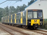 Metrocar 4087
 -
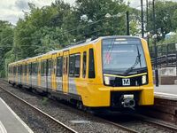 Unit 555004
 -
 Battery loco BL1 dragging a metrocar


Network
[edit | edit source]The Metro network is made up of roughly 172km of rail[5], 2 lines (yellow line and green line), 60 stations, 9 sets of sidings, 42 crossovers[6], Gosforth Depot, Howdon Satellite Depot, Hylton Street Permanent Way Depot, Nexus Learning Centre, the avoid line, and the Manors curve.
The green Line runs between Airport and South Hylton and is 37.5 km long[7]. The yellow Line runs between St James and South Shields and is 50.5 km long[8]. The track between and including South Gosforth and Pelaw is shared between both lines. The yellow line north of the Tyne is known as the "North Tyneside loop". The yellow line is also one of the few rapid transit systems in the world to use a "pretzel configuration", in which it passes the same station (Monument) twice for each destination and from different platforms.
Most of the network is owned by Metro. However, the green line between Pelaw Junction and South Hylton (inclusive) is owned and operated by Network Rail[9], with the line between and including Fellgate and Sunderland shared with heavy rail. As a result, all Metro trains in this section of the network, including empty coaching stock that doesn't usually show on the Pop app, can be tracked through services like Realtime Trains and Signal Maps. Metro owns all of its stations, including those on Network Rail infrastructure[10], except for Sunderland which is owned by Network Rail and managed by Northern Trains[11], and except for Tynemouth which is owned by Station Developments Ltd[12].
Previously, there was red and blue lines, which ran in peak times only. The red line ran between Benton and Pelaw, while the blue line ran between North Shields and St. James. Peak services still run today, except not on their own dedicated line.
| Station | Code[a][13][14] | Opened (for Metro) | Platforms |
|---|---|---|---|
| Airport | APT, APN[b] | 17 November 1991 | 1, 2 |
| Bank Foot | BFT | 10 May 1981 | 1, 2 |
| Bede | BDE | 24 March 1984 | 1, 2 |
| Benton | BTN, BNO | 11 August 1980 | 1, 2 |
| Brockley Whins | BYW, BNR | 31 March 2002 | 1, 2 |
| Byker | BYK | 14 November 1982 | 1, 2 |
| Callerton Parkway | CAL | 17 November 1991 | 1, 2 |
| Central Station | CEN, NCZ | 15 November 1981 | 1, 2 |
| Chichester | CHI | 24 March 1984 | 1, 2 |
| Chillingham Road | CRD | 14 November 1982 | 1, 2 |
| Cullercoats | CUL | 11 August 1980 | 1, 2 |
| East Boldon | EBO, EBL | 31 March 2002 | 1, 2 |
| Fawdon | FAW | 10 May 1981 | 1, 2 |
| Fellgate | FGT, FEG | 31 March 2002 | 1, 2 |
| Felling | FEL | 15 November 1981 | 1, 2 |
| Four Lane Ends | FLE | 11 August 1980 | 1, 2 |
| Gateshead | GHD | 15 November 1981 | 1, 2 |
| Gateshead Stadium | GST | 15 November 1981 | 1, 2 |
| Hadrian Road | HDR | 14 November 1982 | 1, 2 |
| Haymarket | HAY | 11 August 1980 | 1, 2 |
| Hebburn | HEB | 24 March 1984 | 1, 2 |
| Heworth | HTH, HEZ | 15 November 1981 | 1, 2 |
| Howdon | HOW | 14 November 1982 | 1, 2 |
| Ilford Road | ILF | 11 August 1980 | 1, 2 |
| Jarrow | JAR, JAW | 24 March 1984 | 1, 2 |
| Jesmond | JES, JSM | 11 August 1980 | 1, 2 |
| Kingston Park | KSP | 15 September 1985 | 1, 2 |
| Longbenton | LBN | 11 August 1980 | 1, 2 |
| Manors | MAN, MRM | 14 November 1982 | 1, 2 |
| Meadow Well | MWL, MDW | 14 November 1982 | 1, 2 |
| Millfield | MLF, MIF | 31 March 2002 | 1, 2 |
| Monkseaton | MSN, MSP | 11 August 1980 | 1, 2 |
| Monument | MMT[c] | 15 November 1981 | 1, 2, 3, 4 |
| North Shields | NSH | 14 November 1982 | 1, 2 |
| Northumberland Park | NPK | 11 December 2005 | 1, 2 |
| Pallion | PAL, PAI | 31 March 2002 | 1, 2 |
| Palmersville | PMV | 19 March 1986 | 1, 2 |
| Park Lane | PLI, CIC | 28 April 2002 | 1, 2 |
| Pelaw | PLW, PAW | 16 September 1985 | 1, 2 |
| Percy Main | PCM | 14 November 1982 | 1, 2 |
| Regent Centre | RGC, REG | 10 May 1981 | 1, 2 |
| Seaburn | SBN, SEB | 31 March 2002 | 1, 2 |
| Shiremoor | SMR, SHM | 11 August 1980 | 1, 2 |
| Simonside | SMD, SMN | 17 March 2008 | 1, 2 |
| South Gosforth | SGF, SGH | 11 August 1980 | 1, 2 |
| South Hylton | SHL, SHZ | 31 March 2002 | 2[d] |
| South Shields | SSS, SHV | 23 March 1984 | 2[e] |
| St James | SJM, SJN | 14 November 1982 | 1, 2 |
| St Peter's | MSP, STZ | 16 April 2001 | 1, 2 |
| Stadium of Light | SFC, STI | 31 March 2002 | 1, 2 |
| Sunderland | SUN | 31 March 2002 | 1, 2, 3, 4[f] |
| Tyne Dock | TDK | 24 March 1984 | 1, 2 |
| Tynemouth | TYN, TYP | 11 August 1980 | 1, 2 |
| University | UNI, UNV | 31 March 2002 | 1, 2 |
| Walkergate | WKG | 14 November 1982 | 1, 2 |
| Wallsend | WSD, WLL | 14 November 1982 | 1, 2 |
| Wansbeck Road | WBR | 10 May 1981 | 1, 2 |
| West Jesmond | WJS | 11 August 1980 | 1, 2 |
| West Monkseaton | WMN | 11 August 1980 | 1, 2 |
| Whitley Bay | WTL, WHB | 11 August 1980 | 1, 2 |
| Name | Code[15] | Adjacent stops | Number of storage spaces[g] |
|---|---|---|---|
| Gosforth Depot avoiding line | RGC, LBN | ||
| East Boldon up loop | BYW, EBO | 1 | |
| Gosforth Depot | DEP | GEJ, GMJ, GWJ | |
| Gosforth East Junction | GEJ | RGC, DEP | 0 |
| Gosforth Middle Junction | GMJ | SGF, DEP | 0 |
| Gosforth West Junction | GWJ | LBN, DEP | 0 |
| Howdon Depot Junction | HDJ | HOW, HSD | 0 |
| Howdon Satellite Depot | HSD | HDJ | 11 |
| Hylton Street Permanent Way Depot | HYL | MWL | 1 |
| Jesmond Junction, Manors ECS Curve | JJC | JES, MAN | 1 |
| Monkseaton Sidings | MKS | MSN, WTL | 2 |
| Nexus Learning Centre | SSS | 2 | |
| Pelaw Junction | PJC | PLW, FGT | 2 |
| Pelaw Sidings | PWS | PLW, HEB, FGT | 8 |
| Preston Refuge Siding | PRS | NSH | 1 |
| Regent Centre Siding | RGS | RGC | 1 |
| River Drive Siding | RDS | SSS | 1 |
| Stoddart Street Sidings | STD | MAN | 5 |
| Stoneyhurst Road Siding | SRS | SGF | 1 |
History
[edit | edit source]Predecessors
[edit | edit source]This section is intentionally simplified to only what directly lead to the formation of the Tyne and Wear Metro. Where no primary source is provided, the linked Wikipedia articles are the source. For more information about these predecessors, see the linked Wikipedia articles.

Most of Metro's yellow line is based on an older suburban railway known as the "Tyneside Electrics", which itself was based on the steam "Newcastle and North Shields Railway", part of the "Blyth and Tyne Railway", and the South Tyneside line of "Brandling Junction Railway". The N&NSR opened in 1839, running between the temporary terminus Carliol Square (between Manors and what is now Newcastle Central) and North Shields[16]. In 1864, the B&TR, which extended the N&NSR from North Shields to north of Monkseaton, was extended from Monkseaton to New Bridge Street (between Jesmond and Manors) via Benton[17], forming most of what became the North Tyneside Loop. Tyneside Electrics electrified the North Tyneside Loop using third rail and opened their network in 1904. In 1935, Brandling Junction Railway proposed a line connecting Gateshead to South Shields. That line was electrified by Tyneside Electrics and added to their network in 1938. In the 1960s, British Rail de-electrified the network and converted it to diesel operation.
Metro's green line between South Gosforth and Airport is based on the Ponteland Railway between South Gosforth and Kenton Bank (which became Bank Foot). The Ponteland Railway opened in 1905 and continued from Kenton Bank to Ponteland, but this continuation of the line no longer exists. The Ponteland Railway closed to passengers in 1929.
Metro's green line between Pelaw and Sunderland is based on part of the Durham Coast Line, which still runs to this day. This particular stretch of track was opened in 1939 as another section of Brandling Junction Railway.
The rest of the green line, between Sunderland and South Hylton, is based on part of the Durham Junction Railway.
The proposed "Metro to Washington" extension is based on part of the Leamside line[18], which itself is another part of the Durham Junction Railway. This particular stretch of the line was opened by the York, Newcastle and Berwick Railway in 1849 and closed in the early 1990s.
Planning
[edit | edit source]In 1969, local authority staff and consultants were undertaking a study into "a strategic framework for land use and transportation planning in the [Tyneside] area"[19]. In 1971, their findings were published under the title "Transport Plan for the 1980s"[20], and the main recommendation was investment in rail rapid transit. The Government accepted this result and, in December 1972, agreed a 75% infrastructure grant towards the capital costs of the system. On 25 July 1973, Elizabeth II approved the Tyneside Metropolitan Railway Act 1973 which empowered the Tyneside PTE to construct works and acquire lands for the system.
The requirements established through this planning process included:
- Tunnels through the centre of Newcastle and Gateshead, separating it from the main line
- A new railway bridge crossing the Tyne to connect Newcastle and Gateshead
- Re-electrification of the network using overhead lines
- Step-free access to all stations on the network
Construction
[edit | edit source]The first civil engineering contracts were let in 1974, for the construction of the tunnels under the city centres[21]. The tunnels under Newcastle were mainly bored through boulder clay while the tunnels under Gateshead were mainly bored through interweaved sandstones and old coal mines[22].
By 1975, the two prototype metrocars (4001 and 4002) had been built by Metro-Cammell, as had a purpose-built test centre on Middle Engine Lane in North Shields[21]. The prototypes were delivered to the test centre in May 1975[23], where they began the testing process.
Opening
[edit | edit source]The initial Metro network was opened to the public in stages between 11 August 1980 and 24 March 1984. The official opening train ran on 7 August 1980 from Haymarket to Tynemouth, and the first revenue service took place 4 days later between the same two stations[24].
The network itself officially opened on the morning of 6 November 1981[25] with a visit from the late Queen Elizabeth II and Prince Charles, who both travelled on metrocar 4020[26]. The Royal opening was part of a three-week transport festival on Tyneside designed to encourage people to try the Metro[27]. On the same day, Queen Elizabeth II also opened the Queen Elizabeth II bridge, giving it its name and allowing passengers to travel onwards from Haymarket to Heworth[27].
Notes
[edit | edit source]- ↑ Where there are two codes, the first is the one currently used by Nexus and the second is either an outdated code or the CRS code used by National Rail
- ↑ NCA according to some sources
- ↑ In timetables and some APIs, Nexus also uses MTS for platforms 1 and 2, MTN for specifically platform 1, MTW for platforms 3 and 4, and MTE for specifically platform 3.
- ↑ Most passenger-facing information only refers to platform 2. Internally, it is usually referred to as platform 1. Because of the platform's length, it can also be considered and used as two distinct platforms.
- ↑ The old station (no longer used in passenger service) is still referred to internally as platform 1
- ↑ Metro services usually only use two of these platforms, currently platforms 2 and 3.
- ↑ One 555, two metrocars
Sources
[edit | edit source]- ↑ Nexus (18 December 2025). "Metro’s first new train enters customer service" (archived)
- ↑ Nexus (14 August 2025). "Metro’s old trains deliver recycling boost on their final journeys"
- ↑ Nexus (18 February 2025). "New Metro fleet enters customer service on the Sunderland line" (archived)
- ↑ Nexus (4 July 2016). "Metro Train Specifications - a Freedom of Information request to Tyne and Wear Passenger Transport Executive" (archived), WhatDoTheyKnow
- ↑ Produced based on data from OpenStreetMap; Overpass query.
- ↑ OpenStreetMap contributors; Overpass query
- ↑ OpenStreetMap contributors and calculations from BRouter
- ↑ OpenStreetMap contributors and calculations from BRouter
- ↑ Office of Rail and Road (15 March 2022). "Track access agreement between Network Rail and Nexus" (archived)
- ↑ The Tyne and Wear Passenger Transport (Sunderland) Order 1998, SI 1998/3269 (legislation.gov.uk)
- ↑ Office of Rail and Road (12 January 2024). "Amendments to the SAC for Sunderland station"
- ↑ Nexus (13 April 2011). "Tynemouth preserved" (archived)
- ↑ metro-rti.nexus.org.uk/api/stations (archived)
- ↑ Railway Codes. "CRS, NLC, TIPLOC and STANOX Codes" (accessed 22 August 2025)
- ↑ Used in various Nexus timetables and in 'Metro Rule Book's
- ↑ Grace's Guide (29 June 2022). "Newcastle and North Shields Railway" (archived)
- ↑ Young, Alan. "NEWCASTLE NEW BRIDGE STREET" (archived). Disused Stations.
- ↑ Nexus. "Metro to Washington" (accessed 22 August 2025)
- ↑ Nexus (May 2014). "Landmarks in urban transport" (archived)
- ↑ Alan M. Voorhees & Associates; Colin Buchanan and Partners (1972). Transport plan for the 1980's. ISBN 0-904211-00-2.
- ↑ 21.0 21.1 Nexus, "How Metro was built" (archived)
- ↑ Nexus, "How the Metro was built" (archived)
- ↑ Nexus (1 October 2020), "Feature: The Tyne and Wear Metro train fleet at 40" (archived)
- ↑ Nexus, "40 years of Metro" (accessed 26 August 2025)
- ↑ Nexus (2021), "40th anniversary of Metro's Royal opening" (accessed 26 August 2025)
- ↑ Nexus (20 May 2022), "Historic Metrocar gets a Royal makeover for the Platinum Jubilee" (accessed 26 August 2025)
- ↑ 27.0 27.1 Nexus (7 November 2021), "The story of Metro's Royal opening" (accessed 26 August 2025)
